Drone Survey Software
Map and measure your site, yourself, with browser-based 3D surveys.
Request a demoSimplify earthworks progress tracking across the site
The Propeller Platform is cloud-based drone survey visualization and analytics software. Access the measurements and project data you need to do your job, without waiting on an expert.
3D visualizations everyone can understand
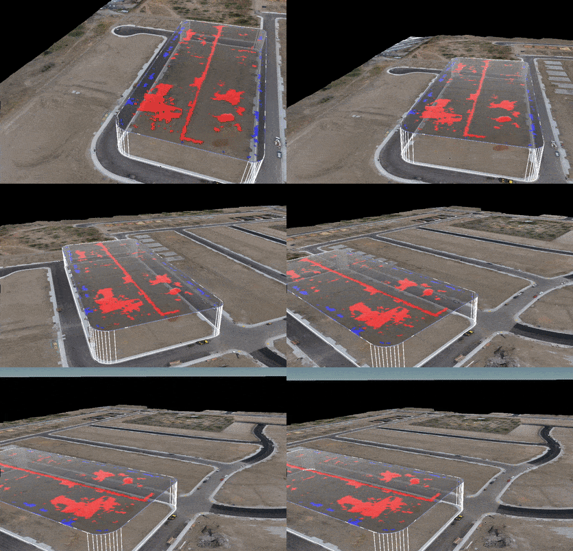
Visualize your UAV survey data using a realistic and geographically accurate 3D model of your project. Not only is a picture worth a thousand words, but it can also help you avoid thousands of dollars in rework.
- Assess how your project is doing today or over its lifetime in the timeline slider
- Use 3D models to conduct virtual walkthroughs, spot hazards, and resolve disputes
- Validate work using a timestamped visual of the current state of your project
Built-in measurement tools
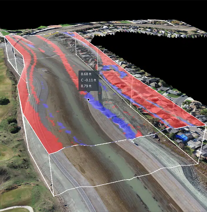
Visualizing drone data is only the beginning. Turn your images into real-world measurements in just a few clicks. Here’s what you can do with the Propeller toolbox.
- Calculate stockpile volume, measure surface area, and visualize cut/fill
- Measure between previous surveys, design files, and sub grade models.
- Edit terrain to remove the inaccuracies and obstructions that cause bad data
The easy way to track earthworks progress
Trade in guesswork for verifiable progress reports you can share with your customers, your colleagues, subcontractors and everyone in between.
- Survey-to-survey comparisons make assessing productivity straightforward
- Layer recent surveys against designs and linework to plan future work and quickly perform design conformance checks
- Track progress using single-point, cross-section, and volume comparisons
Unlimited users, effortless collaboration
Collaborate from a centralized location by inviting team members to Propeller with controlled permissions. Effortlessly generate and share reports to put the right information, in front of the right people.
- Invite an unlimited number of team members to collaborate in your Propeller workflow
- Quickly generate timestamped PDF and CSV reports
- Share downloadable reports and measurements across your organization

Mobile maps made for the field
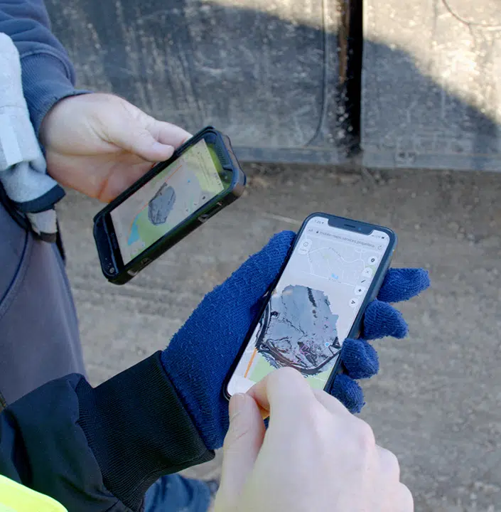
Enhance your Platform experience with the Propeller Mobile App. Gives office teams the power to create and share interactive 2D maps, designs, and earthwork progress with field crews, contractors, and clients.
PDF Overlay
Take the guesswork out of planning.
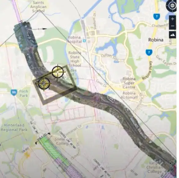
- Overlay PDF designs on top of your latest drone surveys so you can visualize build progress and the future state of the site against reality
- Quickly spot conflicts between what’s designed and what’s been constructed
- View drone surveys and PDF designs in one place to simplify project planning and communication
- Easily add up to 3 geo-reference points to ensure drone surveys and PDF designs line up
- Adjust the transparency of the PDF so that you can easily compare against the drone surveyed terrain underneath
Our Takeoff Report will give you more flexibility, more accuracy and the ability to customize your map.
- You now have the ability to customize grid spacing and positioning to ensure the grid layout fits the whole map area
- You can rotate the map to any angle, including project north, which provides accuracy and flexibility for site conditions
- Customize the heat map color and scale to clearly highlight appropriate areas of cut and fill, making the map easier to interpret
- With more color options, you can now add more pairs of colors to the heat map (up to a maximum of 8 colors or 4 pairs of colors)
- Choose between smooth and stepped colors, plus you can now easily reset the heatmap to the default colors
- With the ability to add different granularity between minor and major contours, you can reduce clutter on the map when viewing on a screen or in PDF format
A simple way to centralize and share your survey data
Are you a Trimble user?
Trimble Stratus Powered by Propeller seamlessly integrates to deliver the Platform to Trimble users.
Platform Features
Cloud-based access
No need to download and install any programs. Just log into Propeller on your browser and get to work.
Easy-to-use analytics tools
Measure volumes, surface areas, road grades, elevation, cross-sections, and cut/fill in just a few clicks.
Composite surveys
Fly and upload small, active sections of your site and then merge them with other surveys to form a more holistic view of your worksite.
Design file workflows
Compare your most recent survey or new design against current design surfaces created from a GeoTiff, TTM or DXF file to measure progress.
Timeline slider
Layer survey over survey to document progress and track changes across the project lifecycle so there’s no question about what got done and when.
Terrain cleanups
Filter out terrain inaccuracies or obstructions in seconds, so you know your quantities are accurate.
Drag-and-drop lidar
Integrate Propeller into your existing workflows with drag-and-drop upload for preprocessed lidar data. View point clouds as 3D terrains.
One-click reporting
Generate PDF and CSV reports detailing the current state of a project and quickly share with all your stakeholders.
Customer quotes
Turn Surveys into Decision Data
Map and measure your site, yourself, with browser-based 3D surveys.
Request a live demo


