


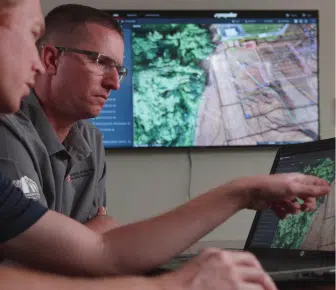
Propeller Platform FAQ
Learn more about the Propeller Platform, a browser-based hub for all your site data, 3D surveys, and analysis
Who are your customers?
Propeller serves companies in the aggregates, waste management, mining, and civil construction industries worldwide.
What’s the Platform’s compatibility with other software?
The Propeller Platform lets you import drone survey data and project designs in a number of file formats. You can also export your drone survey data in a wide range of formats, so that you have easy access to the data you need for existing workflows in programs like Trimble Business Center, Agtek, Carlson, Vulcan, and AutoCAD.
Import
- Survey—Geotagged JPEGs, AeroPoints, GCPs as CSV
- Pre-processed data—GeoTIFF
- Designs—GeoTIFF, TTM, DXF, KML, KMZ, LandXML, CZML
- Point cloud—LAS / LAZ
Exports
- 3d Model (at different resolutions)—DXF
- Orthophoto—GeoTIFF, JFIF, JPEG
- Point Cloud [full site or partial on demand]—LAZ
- Shapefile—CZML
- Survey boundary—GeoJSON
- Terrain
- [full site]—GeoTIFF
- [partial on demand]—DXF, TTM
- Contours [full site or partial on demand]—DXF
- Measurement outlines [on demand]—DXF, KML
Is my data secure?
Absolutely. Propeller is wholly hosted on the Amazon Web Services (AWS) platform, which means we don’t maintain any physical servers or network infrastructure related to the operation of our Platform. AWS provides state-of-the-art data center security that complies with industry standards such as SOC, PCI DSS, and ISO 27001. All physical network and server security responsibility is delegated to AWS.
Much like our physical network security, the majority of our virtual network security is handled by AWS. Amazon provides completely isolated environments where we deploy our applications, and they do so for over one million companies and government organizations across the globe. Some well-known clients who use Amazon to protect their data include NASA, Shell, Autodesk, British Gas, GE, Hitachi, Lafarge, Trimble, and the US State Department. Learn more about Propeller’s commitment to keeping your data secure here.
How do I get support?
We have a dedicated team of experts to assist with customer and data success. Visit our About Us page to learn more about our Customer Success teams.
Can I check out how it works for myself?
We don’t offer free trials, but visit the How it Works page to learn more about the Platform. Alternatively request a live demo of the Platform with one of our team.
How do I upload and process imagery?
After you’ve flown your site, you can upload drone imagery and ground control information using our drag-and-drop uploader. For a step-by-step guide, check out this help center article.
What drones does Propeller work with?
Propeller can work with essentially any drone that has proper camera capabilities. Visit our online Supported Drones and Cameras Tool to learn more.
Can you process thermal or lidar imagery in the Propeller Platform?
Currently, the Propeller Platform only processes photogrammetric drone survey data, not thermal or lidar. However, we do accept the import of pre-processed lidar data (.LAZ files).
How accurate will my 3D survey be?
It depends on the kind of drone technology and ground control you’re using. For a traditional drone (e.g., non-PPK/RTK), and 10 AeroPoints, you can expect to get a 3D survey accurate down to 3/10ft (9cm). With the Propeller PPK solution, you can achieve uniform 1/10ft (3cm) accuracy with only one AeroPoint, (if you follow our recommended best practices) .
Do I need to use ground control when I fly my surveys?
Absolutely. Proper ground control is vital for survey accuracy. Depending on your drone surveying solution, different setups are needed. For a solution like Propeller PPK, you only need one AeroPoint on solid ground to achieve 1/10ft accuracy. For traditional drone surveying, like with a Phantom 4 Pro, we recommend using 10 AeroPoints to achieve survey-grade accuracy.
How do I get my Part 107 to start surveying on my worksite in the US?
Getting Part 107 certified to commercially operate a drone in the US means a formal test with the FAA. Check out how easy it really is in our blog post on the topic.
How do I get my ARN to start surveying on my worksite in Australia?
Getting your ARN certificate from CASA is simple. You can do everything online, just make sure you have ID documents ready. See how it works here.
How long does data processing take?
Once you’ve uploaded your drone imagery and ground control data to the Propeller Platform, data processing takes 24 hours at most. We’ll notify you via email when your 3D survey is ready to view.
How does the Propeller Platform pricing work?
It depends on how often you fly. Check out our plans page to see what plan fits the needs of your site best.
Want to see the Propeller Platform in action?
watch a demo