


Propeller PPK FAQs
Learn more about Propeller’s PPK Solution—the next evolution in drone surveying
How accurate is the Propeller PPK solution?
Propeller’s GPS experts have worked alongside select drone manufacturers to ensure that their L1/L2 GNSS receivers work seamlessly with Propeller’s own developed technology to bring easy, affordable, and highly accurate maps to the wider commercial drone industry. Propeller uses Agisoft Metashape as part of our imagery pipeline to realise survey-grade accuracy
If you are using one of our recommended drones and are following best practices, the Propeller PPK solution can deliver survey-grade accuracy to within 1/10ft (3cm).
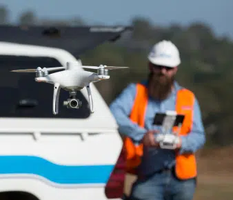
What does the Propeller PPK surveying workflow involve?
In terms of operational workflows it couldn’t get any simpler.
- Plan out your drone’s flight on the flight planning app
- Find a safe, open area on your site to launch the drone from
- Set up an AeroPoint on the ground nearby you and turn it on
- Hit Go on your drone flight
Once the drone finishes its flight and automatically returns to your location, upload your data to Propeller and let us do the processing for you.
There’s no need to download any software. No need to tweak or preprocess imagery or site data. In 24 hours, your 3D site survey is rendered with survey-grade accuracy and you can start measuring and managing your site and your assets immediately.
Does Propeller recommend the PPK or RTK solution?
Propeller recommends PPK over RTK solutions. Because the RTK drone needs to maintain a connection to the base station the whole time it is taking data, any signal loss can have big repercussions in your dataset. Simple maneuvers as flying behind a building can disrupt the signal. Due to this possibility of inconsistency, we recommend PPK workflows over their RTK counterparts.
That said, Propeller does offer support for RTK workflows with high accuracy geotags. Check with your sales representative or in touch here to see if your existing hardware is compatible.
What drones do you recommend for use with the Propeller PPK solution?
Visit our Recommended Drones page to learn more about what drones we recommend for use with Propeller PPK.
Do I still need to use 10 AeroPoints with Propeller PPK?
If you’re using Propeller PPK, are flying a site up to 150 acres (60 hectares), and are following our best practice guidelines then you can achieve 1/10ft (3cm) accuracy using only one AeroPoint. However, in most cases we recommend that customers try to use at least three AeroPoints to ensure they have the best possible chance of achieving the desired accuracy.
You can find more detailed information on how many AeroPoints you need to get accurate results here.
How do I get my Propeller PPK set up?
The setup process will differ depending on which drone you’re using.
DJI P4RTK:
You can find more information on how to get started with your DJI P4RTK, that includes how to download the latest firmware here.
Customers using DJI’s P4RTK are also reminded to activate and attach your DJI Enterprise Care plan to your drone during setup. Learn how here.
DJI M3E (Mavic 3 Enterprise):
You can find more information on how to get started with your DJI M3E, that includes how to download the latest firmware here.
Where can I learn more about the Propeller PPK solution?
For more information on the Propeller PPK solution you can download an in-depth guide here. It covers how a Propeller PPK solution can improve:
- Surveying on a site without any drone technology
- Measurement and management on a site using a drone and traditional ground control
- Drone surveying workflows on sites using AeroPoints