The Value of Construction Progress Tracking Software
The engineering and construction sector remains one of the world’s least digitized. And yet, here at Propeller Aero, we work with customers every day who are revolutionizing their workflows through adoption of construction progress tracking software.
In our 2020 Earthwork Report, we asked over 200 construction, aggregates, mining, and waste management professionals about industry trends, what drives their development, and more. We compared this year’s results to data we collected in 2018 and found that, as drone technology has become more reliable and accurate, adoption is seen as less of a gamble. It’s now considered an asset used for winning bids, saving man hours, and streamlining communication.
When asked which metric was most important to them, construction professionals overwhelmingly answered “material moved”. In fact, 63% answered that way, compared to only 28% two years earlier. More and more, performance is being measured in square footage. Technology has made these insights possible, and will continue to drive the industry toward greater productivity and efficiency.
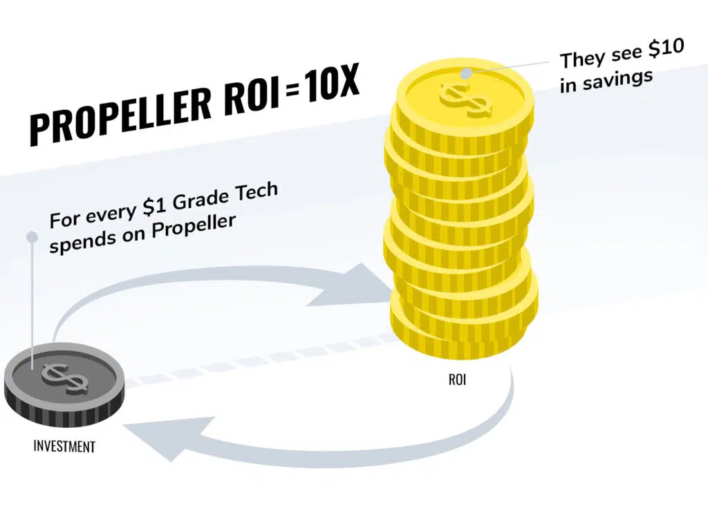
The benefits of construction progress tracking range far and wide, and save our customers 10x their investment (if not more).

Check out the video below to see how Propeller’s progress tracking software works. Then, read on to hear how it provides the kind of value to construction firms that makes investment a no-brainer.
Staying on time, under budget—and knowing exactly how much dirt to move
You can import multiple surface file types into Propeller in just a few seconds. Once you load up your surface, the Propeller Platform’s tools make it easy to compare a survey to your final design. Just run a Compare to Design to view the progress to date, and assess remaining work.
You can also easily measure progress between survey dates with the Timeline feature. Scroll your cursor to see a time-lapse of completed work and cut/fill data. Or overlay a specific snapshot over the design.

Gone are the days of relying on estimates to get paid what you’re due, or to pay out subcontractors. Everyone has the data at their fingertips. With a single source of truth, there’s never any question about work rate or budget.
Conflict avoidance and resolution
Some of the most common conflicts we see in construction, and earthwork in general, are related to the amount of material moved.
A contractor quotes a customer for the total number of cubic yards they’ll need to move for a project. Later, they find out they need to move more dirt than expected. At the end of the project, they need to be able to prove that they did that additional work if they want to get paid accordingly.
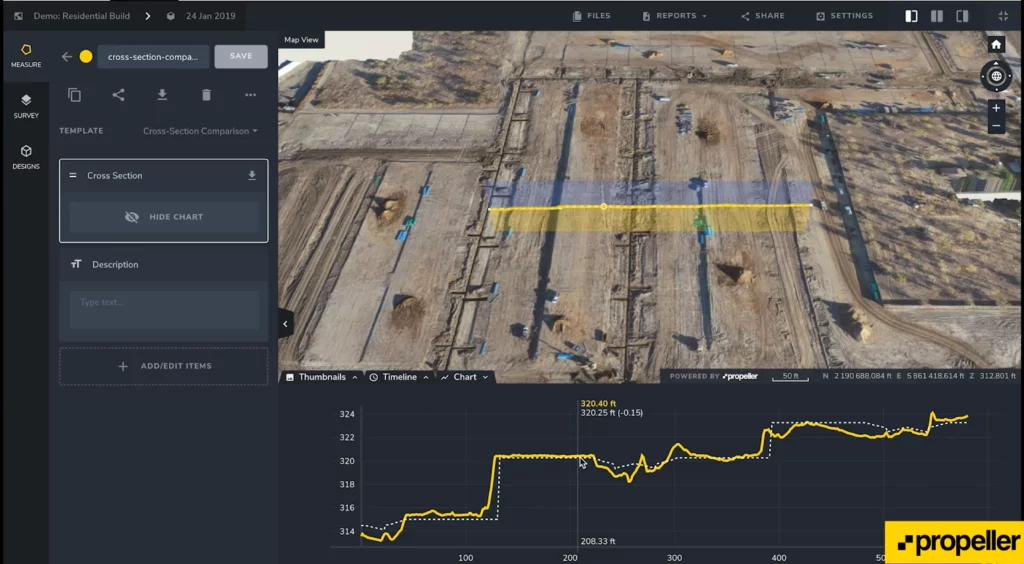
Propeller takes the guesswork out of conflicts by providing accurate records of how much material gets moved between each drone survey. The Propeller Platform’s Timeline feature allows you to compare the most recent survey to any date you flew in the past. You can also use the Polygon tool to do a cut/fill of any area. Or, you can use the Line tool to look at the elevation history of a given point.

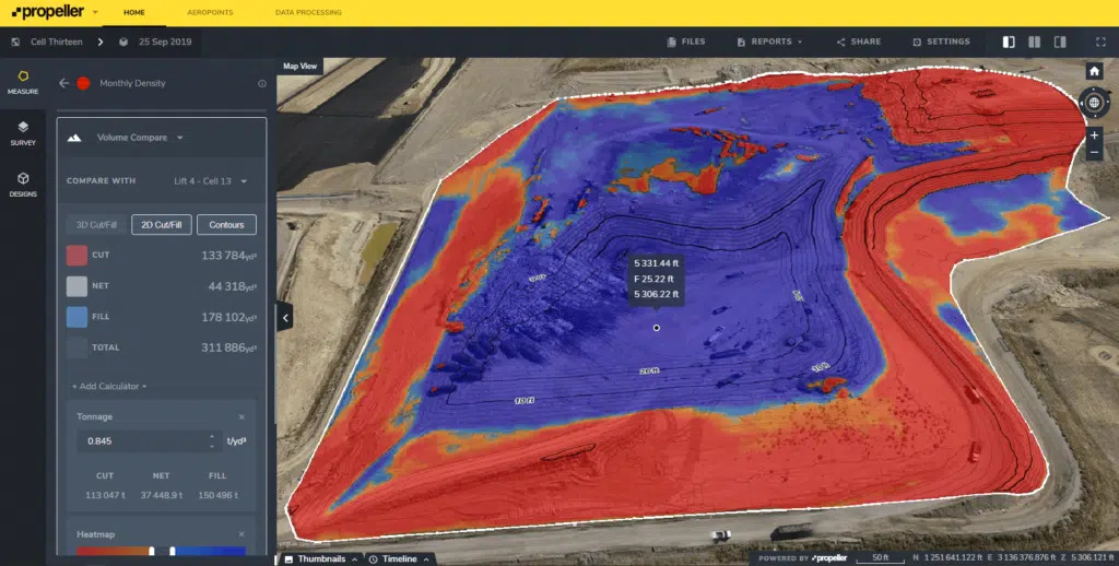
Color-coded elevations provide a quick overview of where and exactly how much material has been moved, accurate within 1/10 ft (3 cm).
Improving client communications
You probably remember the pre-drone world of truck tickets, where loose estimates based on how much dirt could fit in a truck and how many loads could have been moved were converted into real dollars. Even a small estimation error could cost a fortune when applied across thousands of truckloads.
Propeller’s construction progress tracking software eliminates the need for guesswork. Cut/fill maps show exactly how much work has been done, and how much is left to accomplish.

You can add as many users as you need to the Propeller Platform, so you can put everyone’s eyes on the exact same data. For customers and others outside your organization who you want to share progress data with, you can grant View-only access. View-only lets them get a snapshot of your sites over time, while restricting them from creating, sharing, or exporting measurements or reports.
Planning work
Executing well-planned earthwork is a thing of beauty—at least according to our Earthwork Report survey respondents. When asked what motivated them, the answer that received the most responses was “Getting the job done right.”
But if you’re working from outdated surveys, or surveys of inconsistent quality, that bid you won can turn into a nightmare.
Whether you’re bidding or starting a job, construction progress tracking software allows you to take an initial drone survey and compare it to the final design, so you know exactly how much work you’re looking at on any job.
Import a final grade with the click of a button, and can calculate the true scope of a project.

Put real-time data into the hands of everyone who needs it
This is where Propeller really stands out against other construction progress tracking software on the market.
CAD and GIS software has historically been complex and inaccessible to anyone other than trained professionals. If you want measurements while on site, you have to wait for a specialist to analyze the data. Then, they have to create and share a report that can be read on site. And by the time you received it, the information would be out-of-date, rendering all that hard work fruitless.
Propeller’s progress tracking software can be used by just about anyone, since it relies on just three key tools (compared to dozens in CAD software): Point, Line, and Polygon. Just click and drag, then click a button to generate a report.
Crew links make it possible to share all of that critical data to mobile in customizable, interactive site maps. And because we don’t restrict users, there’s no limit to the number of people you can share it with. You decide who sees your data, in or outside your organization.
From surveying our customers, we know skepticism about progress tracking software turns to evangelism as soon as they begin working it into their processes. The technology pays for itself at least twice over through more strategic planning, less rework, and fewer conflicts.
Watch our free webinar to see how real-world companies and individuals are using Propeller’s progress tracking capabilities.
Related Resources:
Is Construction Software Worth the Cost? How (and Why) to Track Software ROI
Calculating Cut and Fill Quantities On Your Construction Site
Drone Surveying ROI Calculator—How Much Time and Money Can You Save?


