New Jersey-Based Petillo Inc. Manages Environmental Issues, Balances Worksite Using Drone Data
As one of the top excavation and site contractors in the greater New Jersey area, Petillo Inc.’s portfolio is full of complex assignments. Recently, they won a site redevelopment job with a long list of environmental concerns in Phillipsburg, NJ, which they knew needed a more organized way of managing material movement for land reclamation and working alongside regulatory entities.
They had tried drone surveying several times in the past and always ran into problems with photogrammetric processing. But thanks to Petillo’s relationship with their Trimble SITECH dealer, they finally found the solution for them: the Propeller Platform and Propeller PPK.
Trimble, the global leader in positioning technologies, was an early partner of Propeller. Our teams work closely together to deliver Trimble Stratus survey-grade drone data solutions for the heavy civil industries.
Richard Tyndall, survey director at Petillo, and Project Manager, Robert Fioretti, gave us the scoop on how Propeller helps them do their jobs better, collaborate with local environmental agencies, and oust guesswork from their day-to-day workflows.
In the I-78 Logistics Park project, a balanced site is key
For the past year, Petillo’s been knee-deep in I-78, a two-phase mission to turn an old industrial facility in Phillipsburg into warehouses.
In Phase One, they’ve been perfecting the grade and calculating how much material will be left in their stockpiles. Phase Two includes developing another two buildings in the middle of the property where some demoing is still needed.
With both phases, “the big thing is trying to keep all the material on-site without having to export it. There’s a lot of concern with export on [this job] because [they’re] reclaiming a site where they don’t want any material leaving for environmental reasons,” Tyndall said.
Report sharing makes site remediation easy
At this point in time, Phase One is still active. It required a whopping 1.6M yards of material movement. “It’s all strategic movement of dirt too. You have a whole lot of different flavors—some can go here, some can go there,” said Tyndall.
By “flavors,” Tyndall means unique (sometimes impacted) soil compositions. The 500-acre site was once used to cast giant motors for boats and airplanes, and after years of ongoing production, the process tainted some of the soil on Petillo’s site.
The New Jersey Department of Environmental Protection (NJDEP) is closely tracking how Petillo deals with the impacted soil. A licensed site remediation professional (LSRP) conducts tests on site to provide guidance for reuse.. “They decide if materials need to be placed down deeper, in a parking lot, under a building, etc.” explained Fioretti.
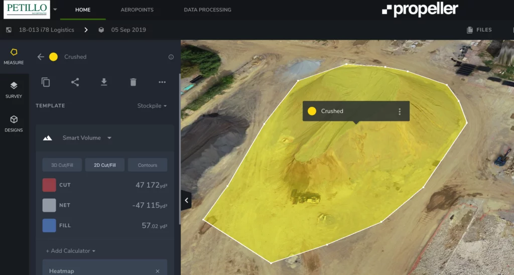
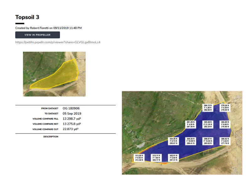
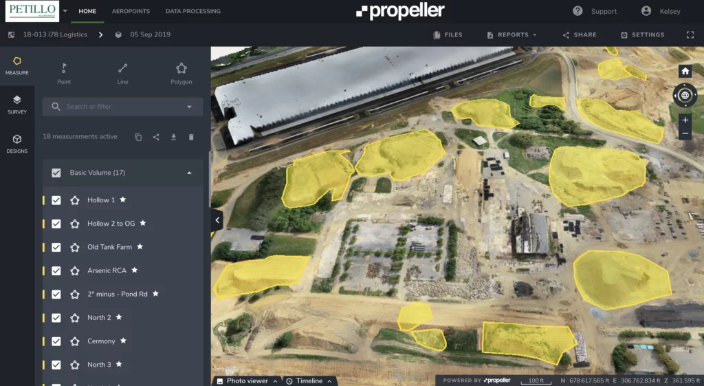
The thing is, with Propeller, “[Petillo] already knows where the dirt went and where it’s sitting right now,” added Fioretti. “We’ve been able to print out stockpile reports with the yardages on them and tell them the original location of soil.”
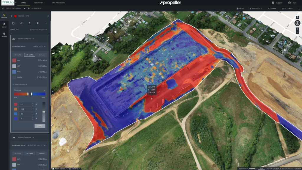
Using the Propeller Platform to maintain an up-to-date visual record of where and when dirt from each of their fifteen stockpiles has moved, has kept operations running smoothly for all parties. Petillo is sharing their reports to maintain total transparency.
Usually, the LSRPs would audit material movement at the end of each project and walk the site to collect data, which would include a lot of guesswork. They’d be “pacing the piles and coming up with rough cubic yardage or shooting a survey, but because we have [Propeller], it makes it almost too easy,” said Fioretti.
As Petillo’s user base grows, more use cases emerge
“We use Propeller how it’s intended to be used—tracking, getting an idea of how much material we’ve moved between surveys and how much we have left to go,” said Tyndall. But as they’ve continued to expand and diversify usage, more use cases emerge.
Now they’re rapidly onboarding users, nurturing client relations with frequent visual updates, and leveraging contour maps to evolve their quantity and quality reporting.
Tyndall gets a lot of requests from his team to quantify a stockpile, justify some of the other buildings, or measure how much material was pushed by a dozer.
“It is super user-friendly, so it’s a matter of getting people to take the bait and start looking at it,” he said. He’s starting to push back on those requests to encourage people to engage with the Platform on their own.
The new visibility has retooled Petillo’s approach to worksite management, as they access substantially more information using fewer man-hours. “[Propeller] helps with the amount of info we can put out in a given amount of time. The quicker you can get that information to the field, the more efficient we are overall,” Tyndall said.
Predictive monitoring shapes project deadlines and equipment sourcing
Micro-improvements in efficiency show on a macro level. One of Fioretti’s main duties as a project manager is to lock-in next steps and preemptively source the materials, equipment, and human capital to keep the project progressing. Having an indisputable record of what they’ve accomplished between flyovers at his fingertips has made his job exponentially easier.
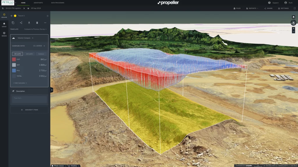
“It’s really helped us with scheduling, in understanding how much more we have to do. We’re trying to see how long it would take us. We get these yardages, and you’re guessing how many yards per day gets moved,” said Fioretti. “You fly it three weeks later and check your assumptions to see how much actually moved. As time goes by, the schedule assumptions became more and more accurate.”
They’re also flagging troubling terrain they’d never be able to spot on the ground, like sinkholes, and intervening earlier. “You could have a safety issue or something you’re unaware of because it’s not visible to you at ground level, and then when you’re flying, you can see it,” explained Tyndall.
Because of progress tracking, “all big earthwork jobs are going to think about Petillo”
For Petillo it comes down to the cost of not knowing. “If you can avoid a mistake or minimize its [financial] impact on a site,” said Tyndall, then you’re putting money back into your pocket.
“There’s also situations where you get into payment issues, and this is an indisputable record of the job at a certain given time,” said Tyndall.
For example, their client decided at the last minute to move the water line 30 feet, cutting directly through a stockpile. “We start telling the client that they moved the line into a stockpile and they can’t really do that; they want evidence,” said Fioretti. “We showed the line, took our drone footage and weighed it on top of it. It was clear as day that it was in the way.”
Fast results and a comprehensive tracking system have made Petillo a hot commodity. They actively share their progress with customers to keep them up-to-date on where their money is going, attaching direct, tangible results to a dollar amount.
Although they haven’t given clients complete Propeller portal access, they do allow them to look over their shoulder to see how they’re ahead of the curve. Fioretti is confident that “all the big earthwork jobs are going to think about [Petillo] because of how [they] managed 1-78.”
Petillo hasn’t just dominated photogrammetry once and for all, they’re now running a tighter, more organized worksite with a single thread connecting all their different parts.
That single thread managing an intricate redevelopment operation? Propeller.
Petillo Inc. uses Trimble Stratus, powered by Propeller.
For more information on how to bring Trimble Stratus to your worksite, please contact SITECH Metro Northeast or your local SITECH dealer.


