How Drone Surveying Has Helped Rickabaugh Construction Become More Efficient and Save Money
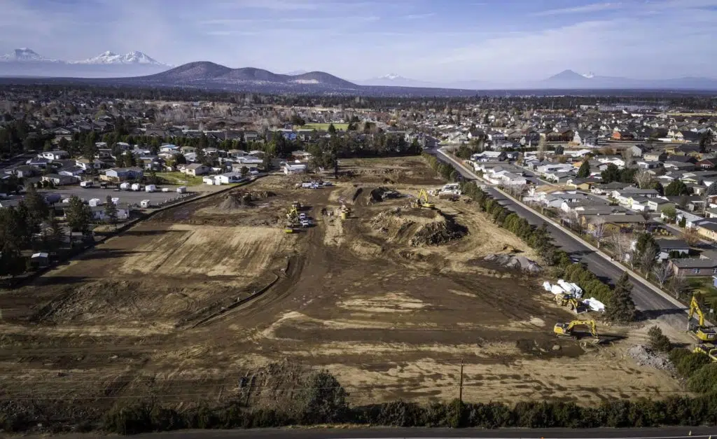
With more than 20 years of experience in heavy civil construction to guide them, Rickabaugh Construction focuses on large-scale projects across Oregon. From humble beginnings in the owner’s barn, they’ve since expanded to a new base of operations in Prineville, Oregon.
Travess Graham started at Rickabaugh Construction as a field foreman, but his interest led him toward the GPS side of the business very quickly. He had worked with drones in previous jobs doing vertical scanning, which sparked excitement about the potential drone surveying on Rickabaugh’s worksites. “I’ve seen the benefits of how much data is available and how quickly it’s available,” Travess shared.
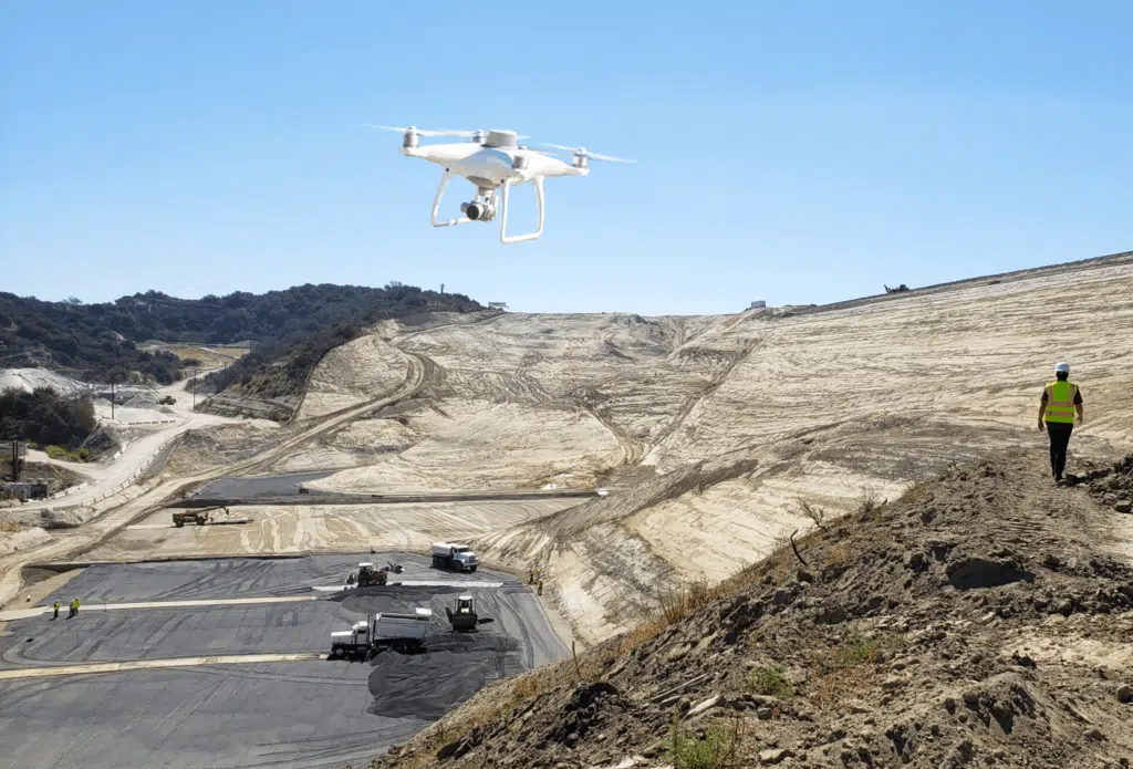
Under his guidance, Rickabaugh Construction started drone surveying with Propeller in 2020. “We got our license, found the Propeller Platform, and fell in love,” says Travess. “It’s cutting-edge. It gives you an advantage over everybody else and sets you apart. I’ve even had city engineers tell me, ‘I wish I had a drone.’”
Read on to learn how Rickabaugh has dramatically improved the efficiency and safety of their day-to-day operations—and saved hundreds of thousands of dollars in the process.
Enhancing worksite safety with drone surveying and Propeller
Rickabaugh Construction has the cumulative industry experience of a much older company, but they began operations in 2016 with a small crew. As their first hire, Travess has watched the company grow every step of the way.
The early days involved a lot of legwork. It wasn’t unusual for Travess to drive hundreds of miles each day between worksites to help calculate stockpile volumes and confirm elevations. And time on the road wasn’t the only problem; grade setters were constantly tripping and falling, risking their safety to keep projects on track.
Once, Travess slipped and fell off a snowy stockpile and was out of commission for months. “There’s no reason to send people out there when you’ve got the technology to do it. I haven’t crawled a stockpile once since we brought Propeller onboard,” Travess commented. “Spending less time on worksites and staying off stockpiles is just safer. This is a great reason to use this drone surveying solution.”
Rickabaugh Principal, Marc Rickabaugh also shared how valuable adopting Propeller has been for their company.
“Before Propeller, we had our projects flown a couple times a year for drone photography, but we did not utilize mapping,” Marc shared. “We used to gather all of our topographic information manually, which was very time consuming and costly. Now, the regular mapping of our commercial and residential infrastructure projects with Propeller provides us with valuable earthwork progress tracking data and stockpile volume management.”

A smooth transition to cutting-edge drone surveying tech
With past experience using drone scans to create 3D maps, Travess knew that Propeller could help the growing team at Rickabaugh Construction stay safe and achieve better results in less time. Yes, there was a learning curve, says Travess—but it wasn’t as steep as he thought. For him, the biggest mental hurdle was getting his drone pilot’s license. He wanted to understand all the rules and regulations that would keep him and others safe. But, Travess admits, “I probably spent way too much time studying for it. I made it out to be more than it was. Even rolling out new software has been a smooth transition for the team. It’s always hard to dig into software, at least for me,” Travess explained. “But there’s always somebody from Propeller there and willing to help you. They’re on it!”

Saving 22 hours of labor a week—and $100k in a single day
Rickabaugh’s weekly drone surveying flights save nearly 22 hours a week compared to their old process of completing hand topos of ground terrain to check progress. “I’m no longer out there crawling over stockpiles and walking terrain. That’s one of the greatest benefits,” says Travess.
In central Oregon, it’s not uncommon to drive hundreds of miles a day from job to job. With Propeller, Travess doesn’t have to head to the job site if someone calls and asks for a ground elevation. He can simply pull over, pop open the most recent Propeller flight, and get the data to the right team members from wherever he is.
Drone surveying has saved Rickabaugh more than time—they’ve also directly saved the company money on a few occasions.
In one instance, Rickabaugh was working as a subcontractor on a new park. The project was closely managed, so missing any steps resulted in problems. Due to a few missing steps in the general contractor’s process, one section of road was paved before it was compaction tested and inspected. The client wanted Rickabaugh to tear out more than $100,000 worth of laid asphalt to allow for testing.
Fortunately, Rickabaugh had flight data from their finished subgrade and compaction testing they had completed along the way. They presented the client with flight data from before the asphalt was laid, the day of paving, and after the paving was finished to show that the compaction was satisfactory and repaving was unnecessary, saving them $100,000 of rework.
“Propeller gave us that extra advantage,” Travess said. “It definitely set us apart and saved us.”
Rickabaugh still flies their job sites weekly to document what they do and ensure they’re doing it right. “A weekly survey flight will always be part of our program going forward. Not just for our clients,” clarifies Travess, “but for ourselves.”
Going into a drone surveying program, Travess knew that a weekly model to verify progress in the field would set them apart from the competition. Quantifying stockpiles—even giant ones—is so fast and easy that “it blows people away,” he said.


