Introducing Media to the Propellerverse: Photos, messaging, and maps—oh my!
They say a picture is worth a thousand words. We think that’s especially true on busy worksites, but with a caveat: a picture is worth a thousand words if you know what you’re looking at. Without context (like where the photo was taken and why), real-time access, or direct communication attached to the image, it’s all too easy to get off track.
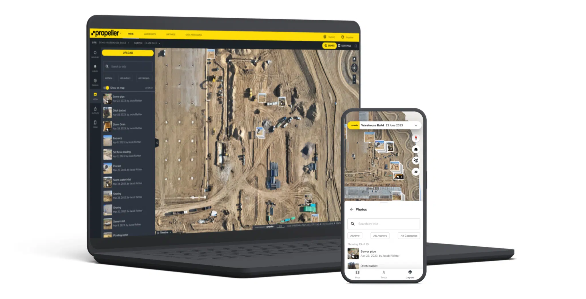
Introducing our latest feature: Media, which empowers Propeller users to pin, organize, and respond to media (think cell phone pics and 360-degree photos) right from the map.
What Media means for you: You and your team can now add, sort, and exchange messages about digital media on your Propeller map. Capture your reality in real time, from any device, to better measure and manage your worksite.
Let’s dive into how Media works and how it can help transform disjointed and bumpy workflows into well-oiled productivity machines.
A picture is worth a thousand words—so long as it’s easy to interpret
Today’s worksites collect thousands of photos, files, and other digital media to capture progress on-site. Photos are exchanged between the field and the office in a constant back-and-forth to help clarify meaning, record progress, and keep everyone on the same page.
But using these photos can be frustrating, because:
- They’re stored in multiple locations, from shared drives to cloud storage to individual users’ phones
- Without location data or other metadata, it’s difficult or impossible to tell where they were taken
- Teams can’t easily react or respond to them in real time
The result? Data silos and fragmented information, contributing to an environment that disrupts productivity instead of supporting it.

How Media works and why it matters
Think of Media as adding a fourth dimension to your map. Not only can you see a three-dimensional view of your worksite; now you can upload, download, tag, and comment on location-based photos without ever leaving Propeller.
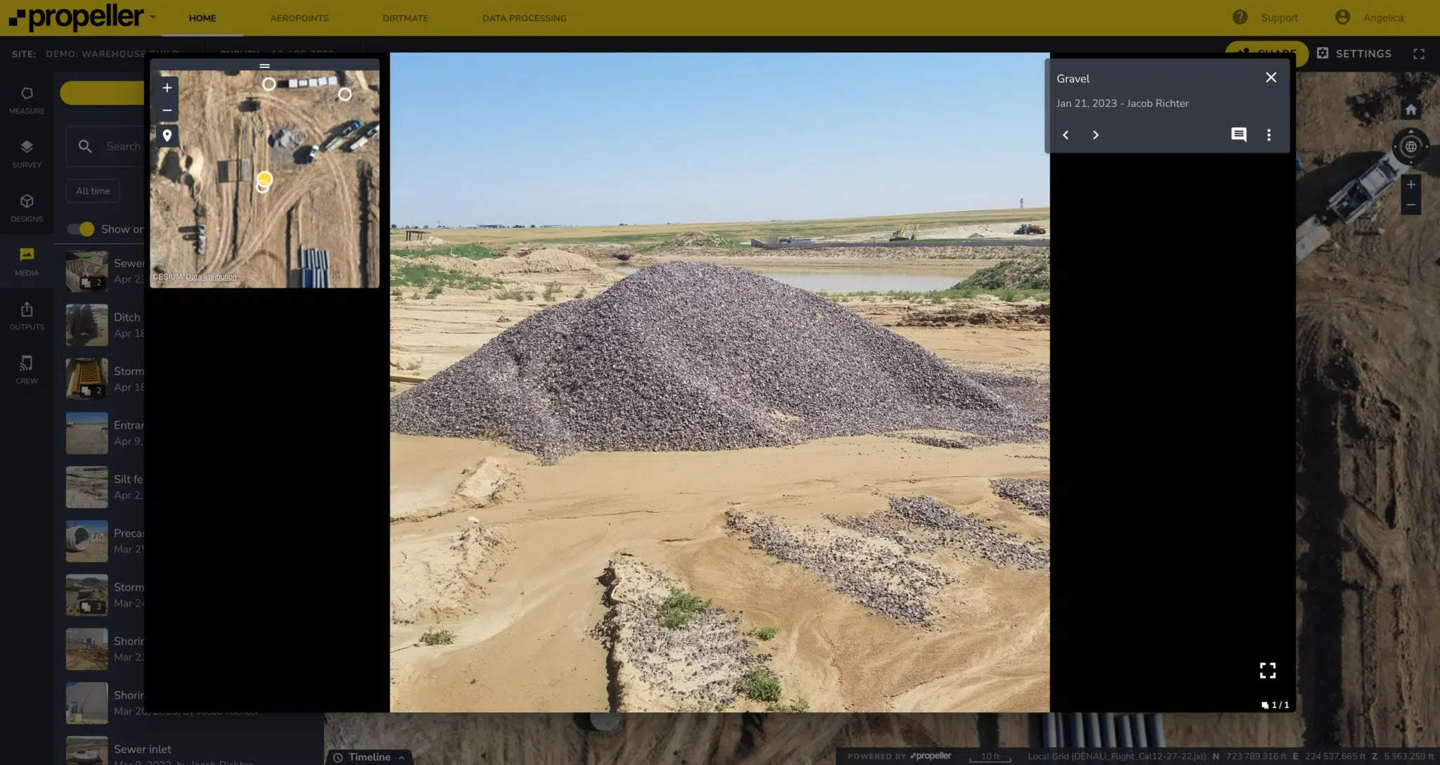
- Picture-perfect photo capture: Capture and upload photos from your mobile library and pin them to where they were taken, either manually or with metadata.
- Work efficiently with bulk uploads: Bulk upload photos in groups, pinning the whole batch to a single location or across all locations contained in their metadata.
- Find what you need with powerful filters: Browse existing photos and filter by author, time/date captured, or category.
- Collaborate in real time: Comment and react to photos, tagging other users to communicate where and when it’s most relevant.
- Never miss a thing: Get notified via email when you’ve been tagged in photo comments.
- Georeferenced images: Pin and reference photos in relation to your map view, then navigate between photos in the context of your location on the map; perfect for moving between 360 images.
- 360-degree support: View, upload, and store 360 images geospatially on the map.
“Propeller Media is invaluable. You can’t put a price on the ease of finding historical photo records years down the track. Photo records are stored in the one system and users can easily find what they need spatially and using category filters.”
— Rion Graham Emmerson, Survey Manager, Acciona

How can Media transform your workflow?
Field-office collaboration
Keep communication clear, efficient, and accessible with real-time updates from the field.
Visual records + progress reports
Organize your digital assets by tag, date, and time, so everything’s on record.
Safety management
Alert key stakeholders of critical site updates and investigate incidents directly from the map.
Effortless data capture, centralized
From photos to 360 images, capture real-time site activity and relevant messages right where you need them most.
Competitive advantage
Showcase your competitive edge with 360-degree walkthroughs, centralized assets, and design overlays.
“Recently, I encountered a challenge with sharing site photos across platforms for easy access with my team. Propeller’s new feature allows users to easily share and geo-tag in real time anywhere on the map. Now my team can collaborate with ease and view site photos at the same time, greatly improving efficiency and communication.”
— Alex Wong, Senior Digital Coordinator, Southern Program Alliance
One map, one team
At Propeller, we understand that the map is a meeting ground. It’s the place where collaboration happens, a universally understood source of truth reflecting every surface, measurement, or photo you collect.
With Media, your map is your one-stop hub for communication and transparency between on-site teams and external collaborators. With just a few clicks, the people doing the job and the people managing the job can access the information they need to do their jobs better, faster, and smarter.


