


How Lidar Drone Surveying Works
After being introduced for commercial use 20 years ago, lidar has proven to be a powerful tool in the surveying toolbox. While a more cost-intensive hardware option for site surveying compared to photogrammetry, it offers many benefits for worksite surveying, progress tracking, and modeling.
As hardware costs continue to go down, we’re seeing more and more worksites using lidar as a part of their surveying workflows.
In light of that, we wanted to cover what this technology is, how it works for drone surveying, and some key differences between lidar and photogrammetric drone surveying.
If you want to learn more about lidar versus photogrammetry, check out our blog on the topic.
What is lidar?
Invented in the 1960s, lidar—also called 3D laser scanning—means “light detection and ranging.” By sending laser pulses at a feature (terrain, trees, or cliff faces) and measuring the reflected pulses with a sensor, you can measure the distance between the features
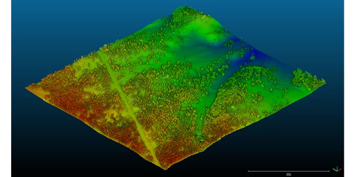
With some trigonometry, you can calculate distances very accurately this way, and with many, many points of reflection (think millions) you can reconstruct a point-based model of terrain, as below.
Lidar is often compared to sonar or radar, which use sound and radio waves respectively to map surfaces and detect objects. In most cases, lidar uses infrared light. The hardware can be mounted on a plane, tripod, automobile, or drone.
How to survey with lidar on your site
When surveying your worksite via drone, make sure you have all the licenses and regulations sorted out before you fly. (If you choose the tripod method, ensure that you’re setting up in a safe place on site, out of the way of equipment and working areas.)

The mechanics of lidar drone surveying in the field are similar to photogrammetric drone surveying. For an in-depth look at how to start a drone program on your site, check out our ebook on the topic.
An average drone surveying workflow, looks something like this:
- Preplanning and base station setup
- Launch and fly your drone
- Landing and wrap up
Pros and cons of photogrammetry and lidar for 3D mapping
The big question about lidar drone surveying is, how does it differ from photogrammetry? There are a few key differences in capture methods and the visual outputs you get from each.
One technology isn’t inherently better than the other. It all comes down to what you want to accomplish. Do you want to survey areas with thick vegetation? Do you want a 3D map that’s photorealistic? Do you want to do your drone surveying at night?
Let’s see how lidar or photogrammetry will help in these scenarios and more.
Weather and lighting conditions
If you’re sending up a drone, you need to have the right weather conditions to fly. This is true for both photogrammetric and lidar drone surveying. Though there are unique conditions to watch out for in the summer and winter seasons.

Photogrammetry requires sunlight, and lidar does not. But it is illegal to fly a drone at night, however no matter what tech you have on it. So if you want to survey with lidar in low light or at night, you can do so with tripod-mounted system.
Visual outputs
The most obvious difference between photogrammetry and lidar is their final 3D map. Because photogrammetry is using actual photos to construct its model, you get real-world visuals of the site, like in Google Street View.
Lidar, on the other hand, is only using light pulses, so you get a 3D model with less visual detail and no photorealism.
Vegetation and “seeing below the canopy”
One of the biggest differentiators is how each technology performs when it comes to vegetation.
Because lidar is actually sending pulses of light into the environment instead of taking photos, it’s typically better suited to survey denser vegetation, like forests.
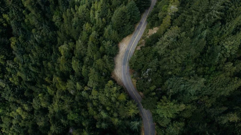
Under good conditions, lidar can penetrate areas with up to 90% vegetation cover, while photogrammetry is closer to 60%. Though, there are filtering tools in some platforms to see what’s down on ground level with photogrammetry drone surveying.
However, it’s important to note that lidar isn’t the same as X-ray vision. Lidar penetrates spaces between foliage, trees, and other flora. Should your site have extremely dense vegetation, you might still have to send a surveyor to shoot a few points under the canopy.
Survey accuracy
When it comes to the accuracy of the survey itself, there are no inherent advantages of lidar vs. photogrammetry.
For both types, accuracy in the air is affected by the movement of the drone, not just the sensor itself. So, no matter what tech you’re using, you’re still running the same data correction. Ground control is also a factor in all drone surveying.
For example, with photogrammetric surveying workflows like the Propeller PPK solution, you can get accuracy of 1/10ft with a few simple tools.
Survey data processing
The time expended on drone-based lidar and PPK drone surveying is on par. Neither system requires traditional ground control setup, just a base station on the ground for data correction.
In some ways, lidar is easier to process simply because it is less detailed than photo-based datasets. However, there is no cloud-based lidar processing on the market at present, you have to do it yourself. In-house processing means computing hardware and a specialist who can properly render and correct that raw data. (Propeller, for example, does not process lidar data, but accepts preprocessed point cloud uploads into the Platform.)
But either way, you get a 3D point cloud of your site. These are 3Ds model of your site, showing you exactly how it was during the survey.
Just as with photogrammetric models, lidar point clouds capture your site in accurate detail. You can use them to measure volumes, like stockpile volumes in your stockyard; gradients, like road grades onsite; and progress to design, if you have design surfaces uploaded into your platform.
All of the above make point clouds important and useful progress-tracking tools for worksite management, no matter your industry.